 As a result of my work on Hadrian's Timber Wall, I was asked recently to take part in a documentary about the period. So, putting prehistory aside, I took another look at this important period in my local archaeology, and in particular at a conspicuous, yet enigmatic, example of Roman military engineering.
The Vallum is a unique linear earthwork to the south of Hadrian’s Wall. When it was constructed, it ran in an unbroken line, following close to the course of the Wall, from Newcastle to Bowness-on-Solway, a distance of about 112km.
There is often another small mound, known as the ‘marginal mound’, along the southern edge of the ditch.[1]

Schematic section of the main features of the Vallum and Wall
Where possible, the Vallum lies close to the rear of the Wall. However, unlike some sections of the Wall, it is laid out in very long straight sections, avoiding steep gradients, with a few very deliberate corners. In the famous central section where the Wall runs along the crags of the Whin Sill, the Vallum stays in the Valley.

Hadrian's Wall: sites mentioned in the text

The Vallum Crossing at Condercum Fort, in Benwell, Newcastle,
on Google Earth [3]
Dating The Vallum
Work on Hadrian’s Wall probably began in AD 122, and the Vallum carefully skirts a series of forts, like Benwell and Birdoswald, which were added early in the construction process, indicating it was built at the same time or shortly after them.

The Vallum to the south of Birdoswald Fort [4]
The defences at Birdoswald soon encroached on the Vallum. One of the later additions, the fort at Carrawbruugh [Brocolitia], probably dating to AD 132-3, was built over the top of the Vallum.[5] This is consistent with a general pattern of backfilling and slighting of the ditch evident from this sort of period onwards. In places, the mounds are breached and the ditch backfilled at regular intervals of about 41m.[1]

The fort at at Carrawbrough [Brocolitia] overlies the Vallum
The Vallum followed the first Wall west of Birdoswald Fort, known as the Turf Wall, closely. When this Wall was replaced in stone on a new course further north, probably late in Hadrian’s reign, there was no attempt to move the Vallum.
Thus, the Vallum was maintained only for a short period, probably less than 10 years, after which it was no longer considered important, or worth preserving, in its original continuous form. Hadrian died in AD 138 and his successor, Antoninus Pius, had a new strategy. He moved the frontier north, and starting in A142, built the Antonine Wall across the Forth-Clyde isthmus.
What was the Vallum for?
The Vallum is unique, which is always a problem to archaeology, where insights so often come from comparing things. While most commentators have draw attention to the road-like nature of its layout, and noted its possible function in communications, they have sort its true function elsewhere.
The Vallum at Down Hill, East of Halton Chesters Fort
Little has changed in our understanding of this earthwork, as Tony Wilmott, a leading English Heritage archaeologist and Wall specialist, made clear recently:
“The straight lengths in which the Vallum is laid out are consistent with distances of the uninterrupted view of a surveyor. Changes in direction tend to occur where a new viewpoint is required to obtain another long straight view. This is the system used to lay out roads. It has been argued that as the Vallum was surveyed as a road would be, it must have functioned as a road. This does not follow, and if we accept that a road would require metalling, and metalling on the berms is sporadic, and sometimes doubtful, we have to discount all of the suggested variations of a function related to lateral communication.
Richmond’s (1930) statement of the function of the Vallum remains valid:
‘
Tony Wilmott 2007 [6]
“ It was not a strictly military defensive system, for the ditch is not of military shape, nor are the symmetrical banks defensive; furthermore, the Vallum takes no account of commanding ground. Rather it is a barrier and line of demarcation defining the rear of the Wall-zone, and preventing entry except at fixed points.”
Sheppard Frere, 1974 [7]
“The Vallum allowed army units to segregate themselves from civilians and to use the zone between the two barriers for grazing military pack animals and cavalry horses.”
David Mattingly 2006 [8]

I have always liked to stress the livestock aspect, just because archaeologists too easily forget them, but the general consensus seems to be that the Vallum defines and secures the military zone behind the Wall, enhancing the ability control access to the frontier. While this is all perfectly reasonable, it could be argued that these functions were a consequence of the Vallum’s construction, and not necessarily its intended purpose. Besides, all of this could have been achieved with significantly less effort. This is what introduces note of an ambiguity; the Vallum is an odd and, above all, inefficient engineering solution. I have a prejudice that Roman civil engineering should be efficient, and built to last, like their roads.
Whatever potential benefits an almost-continuous earthwork may have initially provided, its short life and systematic backfilling suggest these were rapidly outweighed by the disadvantages
The Vallum West of Limestone Edge.
However, there is a simple, and less ambiguous explanation for the creation of the Vallum: It is a construction trench for a road that was never completed.
 Schematic section of the intended plan for the Vallum and Wall
The Vallum as an unfinished road
Quite simply, if a flat bottomed trench, set out like a road, is backfilled with appropriate material and capped with stone, you would create a carriage way. The space between this and the mounds on either side would be the lanes used by riders and pedestrians. It is entirely rational and appropriate that Hadrian would have specified a high quality road running along his new frontier, linking the main military establishments.

The Stanegate to the South-East of Carvoran Fort
The Wall was slightly further north than the previous local frontier, a line of forts linked by a road known as the Stanegate. This had probably served as the northern limit of Roman territory before Agricola’s campaigns in Scotland. While the Stanegate was no doubt still used, and some of its forts, like Corbridge, were still important, the military geography had changed.
The only road constructed along the frontier was the 'Military Way', a not very substantial track running between the Wall and the Vallum. In places it runs along the top of the Vallum’s north mound. Traces of metaled surfaces have been noted on the berms to the north and south of the Vallum trench.

The Wall, Vallum and Stanegate North of Haltwistle Golf Course
The observation that, as far as we can tell, the Vallum is continuous, maintaining its form, from one end to the other, might even argue that it represents one of the few apparently complete aspects of the frontier. Other aspects of Hadrian’s construction project seem to have ‘overrun’ in some way. The clearest indication of this is the decision to change the specification of the Wall, from 10’ to 8’ thick, at some point during the construction process. The earlier parts of the Wall built were 10’ wide, known as Broad Wall, while the later parts were ‘Narrow wall’, only 8’ wide, but often built on a wide foundation.
 Looked at in detail, the fabric of the wall indicates aspects were unfinished, or interrupted; specifications were downgraded and standards lowered. Far from being a smooth operation, breaks detected in the construction projects, known as ’dislocations’, imply that something else was occupying the legionaries' time.[9]
A variety of observations about the archaeological record have led to the suggestion that there was war in Britain during the 120s [10], and there were well attested wars in the east of the empire late in Hadrian’s reign. Events such as these may have caused manpower shortages not envisaged when the wall was first conceived in the early years of Hadrian’s administration.
Notwithstanding that Hadrian’s entire scheme was effectively abandoned by his successor, building the Wall, garrison forts, milecastles, and turrets was clearly not a not straightforward operation. It was one in which an unfinished road would not be out of context.
Detail of Vallum West of Limestone Edge
The practice of Roman road building
We have no technical sources for Roman road construction, despite a much-repeated idea that Vitruvius describes the process.[11] Our only literary source is a poem by Statius praising the Via Domitiana, built by Domitian in AD 95:
The first task here is to trace furrows, ripping up the maze of paths, and then excavate a deep trench in the ground.
The second comprises refilling the trench with other material to make a foundation for the road build-up.
The ground must not give way nor must bedrock or base be at all unreliable when the paving stones are trodden.
Next the road metalling is held in place on both sides by kerbing and numerous wedges.
Publius Papinius Statius c. AD 95 [12]
This poem was written to flatter the Emperor Domitian, which makes another important point: The quality of a road or other civil engineering project was a reflection of the person who initiated and sponsored it. A Roman politician’s prestige and standing was, in part, a reflection of the nature and quality of the engineering of the ‘good works’ that bore his name. In this context, a plan to construct a high-quality, properly bedded, road along Hadrian’s new frontier is not surprising.

A simplified section of a main urban street from Pompeii Via munita [13]
It was standard practice to place inscriptions on Roman buildings and other works indicating who had built them. This was particularly true of the army, and from their inscriptions, it is evident that the masonry aspects of the Wall system were primarily built by troops from three legions [legio II Augusta, legio XX Valeria Victrix and legio VI Victrix].
A total of ten fragments of inscribed stones have been found in the vicinity of the Vallum, and this has led to the suggestion that they relate to the construction of the Vallum. One group from near Denton mentions an auxiliary unit.[14] Unlike the Wall, where such inscriptions are more common, the Vallum, primarily a trench with spoil heaps, offers little opportunity for the placement of permanent inscriptions. Certainly, if the Vallum is an unfinished road, then the credit would have lain in finishing and surfacing it.
The basic form of a Roman road comprised a central carriageway with a hard surface, primarily for wheeled traffic, flanked by wide lanes of softer ground for horses and pedestrians. Ideally, the central carriageway would have a road surface of interlocking stone blocks set in mortar, with a convex profile to encourage drainage. This was built on a roadbed made up from successive layers of graded material.
The roadbed was built up as a mound or agger, or set in a foundation trench or fossa, depending on ground conditions. Foundation trenches have flat bottoms to ensure even distribution of the load. They were usually dug with steep or vertical sides because long-term stability is not an issue in a trench dug to be rapidly backfilled.
Blackstone Edge [possible] Roman Road by John Burke
The Vallum’s form is consistent with its being a construction trench. Boundaries and defences are better served by a traditional, and more stable, ‘V’ shaped ‘ditch’, such as that used to the north of the Wall. Considerable effort has been taken to move the spoil away from the trench, placing the heaps to ensure wide margins on either side. The spoil heaps are neat and carefully constructed to stop their spreading onto these areas next to the trench.
In short, it is not the mounds themselves, but the areas between them and the trench, that are important. Similarly, the trench itself is a void that only becomes functionally significant when, and if, it is backfilled.

Theoretical Structural Archaeology
Creating foundations for buildings and other structures is one of the most important reasons for digging holes in the ground, and TSA is about understanding features from an engineering perspective. I do not intend to look at the logistics in detailed, and they can only be seen in the wider context of building the frontier, and this has been well covered by Peter Hill.[9]

Possible layout of Vallum in Roman feet [15]
Using the classical model for the Vallum, laid out in Roman feet, he suggests 1,465,313 m³ of material were excavated and moved to the North and South mounds. He points also out that more labour was required to move the spoil than was expended in digging the trench.


However, if the trench was going to ever to become a road, a similar volume of material was going to have to found for the backfill. Simplifying the maths, one and a half million m³ of backfill would weigh at least three million tonnes, probably more -- a perfectly good reason why the scheme was never completed.

If you are having trouble visualising these figures, the large 8-wheeled lorries [tipper truck, left] used to move this sort of material on our roads take about 20 tonnes; to finish the job you would require 150,000 lorry loads of hardcore, sand, gravel, lime and surfacing stones. In the absence of lorries, the Romans had the Army. However, digging a foundation trench, and even backfilling it with hardcore, requires considerably less skill and specialised resources than the construction of walls using lime mortar and dressed masonry.
So in terms of the wider picture, the Vallum may have not yet used legionary manpower, although this might be required for surfacing and finishing a road.
If that was the case, its construction, thus far, may have involved auxiliary troops. In addition, we cannot preclude the use of prisoners of war, convicts, levies, and slaves for some of these basic tasks, freeing the legionaries for more specialised construction tasks.
Digging the Vallum
The ditch would be dug using mattocks, which were standard issue to the Roman army, but there are three basic possibilities for removing the spoil:
- Men with baskets;
- Animals, probably asses/donkeys with baskets [panniers];
- Carts or wagons, probably pulled by asses or oxen.
Although the latter is probably the most efficient, the actual method could be a combination of all three. While ard marks from ploughing, hoof prints, and even cart marks [16] have all been been found under and around the Vallum mounds on occasions, I am not aware of any archaeological work directed at this question.
Since the ground along the steep sides of the trench is potentially unstable, the spoil can only be extracted from either in front, or behind, the excavation, and thus, two possible methods of construction suggest themselves:

Two models for spoil extraction from the Vallum.
- Forward extraction
The trench is excavated with the spoil being lifted forward and upward to the carts or baskets, and from there to the spoil heaps being constructed in parallel with the trench. The disadvantage of this method is that all the spoil has to be lifted from the excavation to the bed of the cart, or into baskets, a task that becomes more difficult as the excavation gets deeper.
- Reverse extraction
In this method, the spoil is loaded downwards into carts or baskets using the trench to take the spoil out backwards. If the trench face is reduced in spots, all but the lowest can be easily loaded into a cart or baskets, and potentially, the draught animals do the hard work of lifting the material by means of a ramp at the start of a section of the works. In addition, by dumping the material ahead of the trench, it is possible that as the excavation goes forward, the spoil heap moves backward, and so the distance between the two and the time taken to move the spoil remains fairly constant.
The first method relies on human power to lift the spoil from the trench, whereas the second uses draught power for part of this the task, but would move the spoil a greater distance and requires the transport to able to turn in the trench.
The Marginal Mound
The intermittent presence of this feature to the south of the Vallum ditch has probably prompted more debate than anything else. It was once the basis of the belief that the Vallum had been recut. A connection has also been suggested between the backfilling of the Vallum to create causeways, and the presence of the marginal mound.
In a road-building exercise, the trench would have had to be used to transport the layers of backfill to form the roadbed, since it is impractical to tip from the sides. Assuming that the spoil heaps are built from their ends, once completed, there would be nowhere to put additional spoil that might be created from a final cleaning of the of the trench, or from removing access ramps. This may account for the presence of the marginal mound; there was nowhere else to put excess spoil.

The Wall complex looking East at Cawfields
However, why this seems only to occur along the southern lip of the trench has also to be accounted for. The south side is often the down-slope side, but probably not consistently enough for that to be of significance. More reasonably, its presence may indicate that the north side, next to the Wall, was already being used for communication. This is also suggested by metalled surfaces that have been observed in places on this side, and by the later use of the North Mound as an agger for the Military Way.
If marginal mounds relate to the removal of ramps from the construction trench, then these may have been regularly spaced. Could the observation that, in places, the trench is backfilled at regular intervals of 45 yards /41m [140 pes ?] be related to this?
In other words, do the places where the ditch was backfilled to create crossings reflect the lengths in which the trench had been dug and the mounds constructed, and perhaps the positioning of temporary ramps used to extract spoil during construction? This could explain any relationship observed between the marginal mound and the crossings. If the material comes from removing temporary works, and especially if it derives from a final cleaning of the trench, then work on the construction of the roadbed was expected to begin imminently.

The Vallum West of Carrawbrough
Rethinking the Vallum
"When I see a bird that walks like a duck and swims like a duck and quacks like a duck, I call that bird a duck."
James Whitcomb Riley (1849–1916)
If I was a Roman engineer, and I had been instructed by the Emperor to build a road connecting the forts along the route of his new frontier, having surveyed a suitable route, the first stage would be to dig a continuous flat-bottomed foundation trench, dumping the spoil far enough away to allow for two wide lanes on either side of my main carriageway. I would then backfill the trench with layers of carefully graded and packed material, capped with a mortared stone surface of interlocking stones set in mortar on a bed of concrete.
It’s hard and demanding work, but the results last for centuries. If you want a boundary, I would dig you ditch; it’s cheaper.

Profiles and archaeological sections of the Vallum [17]
The Vallum is laid out exactly like a road; it relentlessly maintains its course, and importantly, its levels. It punches through the hard rock of the dolerite Whin Sill at Limestone Corner and Black Carts, at a point where the Ditch in front of the Wall gives up. The base of the trench tends to be as wide as possible, which is why the sides are almost vertical when cut through solid rock, an unsustainable angle in softer material.
Starting from the bridgehead at Newcastle [Pons Aelius], not Wallsend, for a lot of its course the Vallum runs quite close to the Wall, with little room for any kind of 'zone'.

The Wall complex from Cawfields to Whinshilds
A key observation is that the form of the ‘trench’ is maintained by building up the edges rather than digging when it crossed soft ground at White Moss, Cumbria [below left]. The form of this earthwork, in the context of Roman civil engineering, can only be justified as the foundation for a roadbed.
There are far more efficient and stable forms that can perform as a boundary. This ‘function’ could equally well simply derive from the consequences of having a continuous trench with very few crossing places running for 112km across the country. The continuous nature of the Vallum does not last very long, probably less than a decade, after which the disadvantages of this arrangement clearly outweighed any perceived utility. ‘Restricting access’ to the wall zone may have soon amounted to ‘hampering mobility’ for the Roman military.
While the digging the trench [Fossa] would represent a massive investment of manpower, moving the spoil 30’, or more, to the mounds, expended more resources than digging the trench.
Clearly, the spoil has to go somewhere, but this is a wasteful inefficient solution if the objective is to create some form of boundary.
The Vallum West of White Moss
Put simply, if one ditch and a mound would do the job, why build two mounds so far from the ditch?
Any continuous mound, perhaps 5’ high, would be a barrier to traffic, but two such mounds only make sense to control access to the road that was to be built in the trench. All the arguments advanced about the Vallum cutting down the number of crossing points, and controlling access to the frontier, can be put forward in terms of right of entry to the planned road. The ‘zone’ controlled by the Vallum is its own, as befits the axis of rapid communication between the forts.
The Vallum cannot be understood in terms of other frontiers, or even other engineering projects, because it is unique, or rather, while it is unique. However, if it is accepted as an intended road, it becomes typical, explicable, and comparable in terms of its layout, course, and morphology, with other aspects of the Roman road network. It turns out to be part of the pattern, and has lost its ambiguity. Furthermore, it becomes another unfinished aspect of the Wall, or rather, would add weight to the argument that the project shows signs of being downgraded, and finished in a hurry.
In many ways, it may be viewed as the clearest indication yet that manpower resources were significantly stretched. In terms of materials, if you think of a road as a Wall lying on its side, you can see why it might not have been finished, especially given the apparent pressure to finish other more customer-facing aspects of the Wall.

The Vallum and Turf Wall west of Birdoswald Fort
The Vallum has all the features of an unfinished road, a perfectly reasonable context, and makes military engineering sense only if this was the case. I can find no aspect of its archaeology that does not support this view. I am certainly not the first to propose this, or intimate it, since, at the very least, the Vallum’s layout and morphology have always suggested it.
What has confused the issue is the perception and physical reality of the Vallum as a barrier, and something that is a bar to communication. The continuous mounds and ditch appear obstructive, and can be easily seen as obstacles analogous with the Wall. Indeed, the origin of the name ‘Vallum’ come from a misunderstanding in early attempts to reconcile historical accounts and the physical remains; a vallum is a timber fortification like the Timber Wall [from Valli, a stake], as distinct from the Agger that it sat on, and the fossa in front of it.
Conclusions
Thirty spokes unite in one nave; the utility of the cart depends on the hollow centre in which the axle turns.
Clay is moulded into a vessel; the utility of the vessel depends on its hollow interior.
Doors and windows are cut out in order to make a house; the utility of the house depends on the empty spaces.
Thus, while the existence of things may be good, it is the non-existent in them, which makes them serviceable.
The Sayings of Lao-Tzu, China c. 6th Century BC [18]
A lot of archaeology is about seeing what is no longer there, such as the post where there is only a hole, or the wall where there is only a robber trench. This explanation of the Vallum requires the reader to imagine what was never there, to fill the void, and see its original utility in terms of what might have been.

That the Vallum was dug as a foundation trench for a road is perfectly reasonable, legitimate, and rational, both as an imperial aspiration and as an archaeological explanation. Its enclosing banks and route between the forts makes clear that this was to have been a military road, for moving troops, just like the B6318 built by General Wade that runs beside it for much of its eastern route. It was planned as a strategic road, and it shows no great concern in trade, taxes, or the native interests in transhumance.

That it was to remain unfinished, an abandoned project, and a lost aspiration, within a few years, also tells something else very interesting about the building of the frontier. It signifies that the Wall was built under pressure, and that the project had fallen foul of strategic misapprehension. Something had gone wrong. The decision to place an additional fort at Carrawbrough, over the backfilled Vallum, shows that the vision, and priorities, had changed.
Regarding the Vallum as a road in-the-making fits into a wider picture that is beginning to emerge, suggesting that the period of the Wall’s construction was marked by political instability and warfare. With the benefit of archaeological hindsight, we might view the whole project as unfinished, or even a failure, but the Vallum, even in an incomplete state, represents a considerable feat of Roman Military engineering, and a new insight into an ambitious imperial vision.
Sources and further reading
[1] The basic archaeology of The Vallum and other aspects of the Wall has been recently reviewed in: Wilmott, T., [ed]. 2009. Hadrian's Wall: Archaeological Research by English Heritage 1976-2000.
[Most of the general information about the Vallum, used in this article, is drawn from the summaries of P72 –75 & 131 –136 cover, along with that from individual excavation reports] at http://www.english-heritageshop.org.uk/mall/productpage.cfm/EnglishHeritage/_51324/288647/Hadrian's%20Wall
[2] Earlier work on the wall: Hodgson, E. 1897. "Notes on the Excavations on the line of the Roman Wall in Cumberland in 1894 and 1895," Trans Cumberland Westmorland Antiq Archaeol Soc, o ser, 14, 390-407.
And Haverfield, F. 1897. "Report of the Cumberland Excavation Committee, 1896," Trans Cumberland Westmorland Antiq Archaeol Soc, o ser, 14, 413-433.
[3] This article uses illustrations based on images from Google Earth: http://www.google.com/earth/index.html
[4] Tony Wilmott, Hilary Cool, and Jerry Evans. "Excavations at the Hadrian’s Wall fort of Birdoswald (Banna), Cumbria: 1996–2000," in Wilmott, T., [ed]. 2009. Hadrian's Wall: Archaeological Research by English Heritage 1976-2000. After Fig.346, p. 252.
[5] Inscription RIB1550 refers to Governor S. Julius Severus
http://www.roman-britain.org/places/brocolitia.htm
[6] Wilmott, T. 2007. The Vallum. http://www.dur.ac.uk/resources/archaeological.services/research_training/hadrianswall_research_framework/project_documents/Vallum.pdf
[Accessed 29/11/10]
[7] Frere, S. 1974. Britania. Cardinal Books. P 156 –7
[8] Mattingly, D. 2006. An Imperial Possession; Britain in the Roman Empire 54BC –AD409. Penguine: Allen Lane. P 158
[9] Hill, P. R.. 2006. The construction of Hadrian's Wall. Tempus. [Vallum logistics p 126-7]
[10] Breeze, D.J. 2003. "Warfare in Britain and the Building of Hadrian's Wall," in Archaeologia Aeliana 32, 13 –16
[11] This would appear to derive from confusion over the word pavimentum, a term used to describe a concrete floor, such as the base of as mosaic. [Viruvius. De Architectura, lib. VII cap. I.] In early scholarship, e.g.: Roman Roads in Britain by Thomas Codrington. 1903. Published by the Society for Promoting Christian Knowledge, London.
http://penelope.uchicago.edu/Thayer/E/Gazetteer/Periods/Roman/Topics/Engineering/roads/Britain/_Texts/CODROM/1*.html [Accessed 29/11/10]
[12] Publius Papinius Statius, c. AD 95. Extract from Via Domitiana Silvae 4.3
[13] After: http://upload.wikimedia.org/wikipedia/en/4/4d/Via_Munita.png Roman Road; Via Munita [from Smith, W. 1875.. A Dictionary of Greek and Roman Antiquities. John Murray, London. [Accessed 29/11/10]
[14]. A full list can be found at http://www.romanbritain.org/epigraphy/rib_hadrianswall.htm
Which states; “8. Vallum stones. In 1936 five stones were found by the north and south mounds of the Vallum at Denton and a sixth stone was found to the west in 1953. One stone gave the name of an auxiliary unit, cohors I Dacorum, and the other five all seem to have named centurions. The stones, clearly building records for the Vallum, are thin, square slabs, and seven further examples, two with the names of different auxiliary units, have been recognised elsewhere on the Wall.” [Accessed 29/11/10]
[15] This was suggested by Heywood, B. 1965. "The Vallum- its problems restated," in M G Jarrett and B Dobson (eds). Britain and Rome: essays presented to Eric Birley. (Kendal), 85-94
[16] Bennett, J, and Turner, R. 1983. ‘The Vallum at Wallhouses, Northumberland: Excavations in1980 and 1981’, Archaeol Aeliana, ser 4, 10, 61-78 [fig. 9 p72]
[17] White Moss and Limestone Corner after: 1897. Trans Cumberland Westmorland Antiq Archaeol Soc, o ser, 14, Plate I.
Others:
Wilmott, T. 2009. Hadrian's Wall: Archaeological Research by English Heritage 1976-2000. English Heritage, Swindon. Crosby-on-Eden; fig.233 p126.
Appletree: after Fig. 217, p109.
Birdoswald: after Fig 350, p 257 [scale is 5m not 10m].
Black Carts: after fig.202, [scale 2.5m not 5m] .
[18], Giles, L, trans. 1905. The Sayings of Lao-Tzu. PP 43-44:
http://www.sacred-texts.com/tao/salt/index.htm [Accessed 29/11/10]
Photographs:
Blackstone Edge Roman Road by John Burke,
http://www.flickr.com/photos/bispham2/912576279/sizes/o/in/photostream/
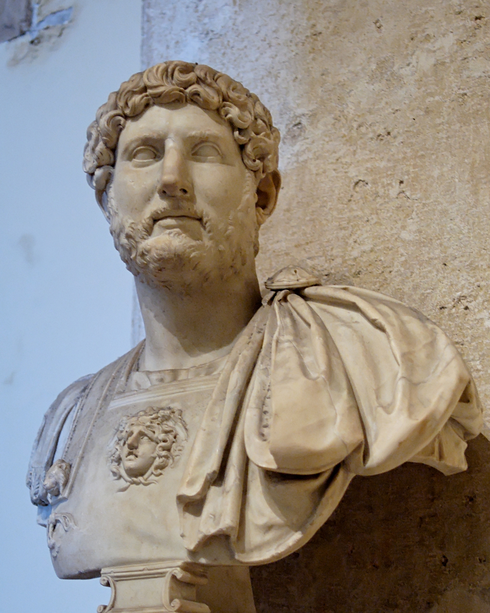
Bust of Hadrian, after: http://upload.wikimedia.org/wikipedia/commons/d/d7/Bust_Hadrian_Musei_Capitolini_MC817.jpg


24 comments:
Great article and another remarkable insight into Hadrian's Wall. You make a well-structured argument for the vallum's purpose as a potential roadway, but as someone who has helped build roads (tamperman, Tilcon: Haltwhistle 1974) I have a problem with the theory. Roads are, and as far as I'm aware, always have been, built in relatively short stretches for reasons of efficiency, ease of supply and use of manpower. I'm not an engineer or an archaeologist, but I can't imagine a scenario where someone would build a 74 mile foundation trench and then go back to the beginning to fill it in. I also wonder if Roman engineers, who were as you point out remarkably efficient, would start a project without sourcing the materials (the backfill) to complete at least part of it?
Could it have been a temporary canal to transport supplies and construction material for the wall? Maybe the mounds were for escorting troops or guards to have a better view of the countryside and to protect and conceal the workers digging the canal?
Hi Doug, Thanks for the comment. What I think is that the Romans had a pool of less skilled labour for basic physical tasks like ditch digging. This freed up the skilled army units for the more specialised building.
Work tends to organised in seasons, and I suspect the Vallum was dug in a single season.
The sourcing suitable materials for the road bed would be a longer term project.
Hi Odin's Raven
That's a great idea that has to be considered as a possibility, but sadly the levels don't really work, and bits of it are simply too steep.
The way the trench is built up over soft ground at White Moss was once described as "like a canal", but this is consistent with it being a trench for a road bed.
Thanks Geoff, I stumbled on your blog through a Twitter reference today and I'm looking forward to reading your back catalogue. I do a bit of writing and it's the tiny details most people don't know about that can sometimes make a big difference.
Hi Doug,
Great to hear you write; so you will know the problem of knowing what and how to write. "The devils in the detail", - and I'm a bit between a rock and a hard place on that one. The detail is important, but often boring. [Few people read archaeological reports for fun]
I am trying to write for a variety of different audiences, so I look for the key incite-full detail, and I try to hold back other things, or put them in a drawing. I hope any more specialist readers will be able to fill in the blanks, and make the connections for themselves.
I still going to have to write a further article to cover the bigger picture, and how both the Timber Wall and Vallum fit with it.
I'll be very interested in that one Geoff, one of the ideas I have for the future is a novel that takes the wall from it's first days to the end when Rome cut Britain off; something like Edward Rutherfurd's Sarum.
Personally, I love archaeological reports. When I lived in Melrose I must have read Curle's book about Trimontium thrice. For my latest book Hero of Rome, I relied on Phil Crummy's City of Victory to help me paint a picture of Roman Colchester. I never take someone else's conclusions for granted - sometimes when you're living it through your characters you get a different idea - but all that wonderful archaeological detail helps you build the foundations.
Small world Doug; I worked for Philip Crummy; I supervised some of the excavations at Culver St; Colchester, biggest, ugliest, most complex, hole in the ground I was ever involved with.
I think writing fiction, re-enactment, feature films, and gaming, all have legitimate questions to ask of archaeology, which in turn force archaeologists to think about the past in different ways.
I am trying to present my research in a new way, making use of a new type of media to do so. Having material universally available, in colour,in any language, and linked to similar material, engenders a different approach to writing.
There is a lot more I could do, and many fellow bloggers are already doing it.[resources!]
There are some great detective stories on the Wall, all based on attention to detail.
Good luck with the book, I hope my next article will give you more background, as I have a few more observations to make about the process.
Hi Geoff
Good to see you back!
I was considering the value of a make work project to keep legionaries busy and fit whether the road was important to the wall or an unnecessary convenience.
The road may have been such a program that was abandoned when the work force{legions) were needed elsewhere? Just a thought.
Ps. As you know I am really bad at the WOGE so in the future do not hesitate to dumb it down for your simpler guests like me.
Peace:)
Hi Tim,
Good to be back, I do feel guilty when I am detained on other matters.
I think I read it was Augustus that introduced the idea of keeping the legions busy in engineering and other works. 'Painting the stones white' on a monumental scale.
I don't think this was case here; this is part of an attempt to build a solid frontier.
re. WOGE; it is quite difficult find interesting sites. I am sorry if they have proved difficult, I Want them to be solved in a week - any longer and you wonder if you misjudged it. Most of mine have been fairly well known in European prehistory. [not 101]
You can only put up Stonehenge once, and it is meant to be a bit of detective puzzle; unless you are lucky.
I have no idea where to find Heather's - I looked in all the ovious spots;
WOGE 103
http://woge20.blogspot.com/2010/11/woge-103.html
But it does not mean I wont find it.
Dear Geoff
Excellent article. Funny how it takes someone telling you the obvious to realise it's obvious. I also like the way your discussion suggests possible motives and circumstances for past actions which are otherwise lost.
Adding a human historical aspect to archaeology is always difficult and, even if wrong, it gives you something to think about that pits and bits rarely do.
Dare I ask, are you thinking of writing your wall-work up and submitting it to the bears?
Strangely all this talk of work for work's sake makes me think of Nazi Germany... or quite a few modern states. I suppose you were at the height of empire when such things could be undertaken.
Ned
Dear Ned,
Thanks for taking the time to read and comment, there is danger in ascribing human motivation to specific archaeology, but engineering is often self explanatory, and you are on firmer ground.
That it is a road, I think, as you say, is obvious; beyond this, Hadrian's motivations, aspirations, and strategic vision, that really is getting close to 'history'. As is the interesting question, why was it abandoned?
I am working on a follow up, which I hope to finish before the government sends me to a camp for the work-shy.
Great blog. Friggin post holes, I mean wow. :-)
m-
Thanks Michael,
Postholes are the features we find most often in UK archaeology, but understand the least - but they are the buildings and structures we are looking for.
Fantastic post; Excellent Blog.
Still trying to process all the details.
Keep up the fine work!
Thanks Steve, I hope there is more to come on Hadrian's Wall.
Another way-out idea. Could it have been the base for an aqueduct that was never built? The garrison along the wall would have been like an elongated city, who presumably would have wanted water. There was a TV programme last night on the ancient world, which mentioned that aqueducts sometimes ran beside roads.That could allow for the steeper portions having legs of different length, letting the top be sufficiently level. Presumably there must be springs and streams nearby which could have supplied the water.It might have been part of the propaganda to impress and corrupt the natives with the amenities of civilistion after the legions had whacked them.
Hi O's R,
Again, sadly, the levels would not work, but as you say, water supply is a very important consideration.
However, there are aqueducts known from the forts, and what is interesting is that some are fed from water sources north of the wall.
This tells us that military control clearly extended north of the Wall.
[I think this was the case at Halton Chesters, Chesters, & Great Chesters].
Hi Geoff,
Thanks for that. Not all nice ideas actually work out, eh?
Do you intend to extend your investigations and ideas beyond England?
Here is a site about Newgrange and its environs.
http://www.carrowkeel.com/sites/boyne/cursus.html
It mentions that there were timber circles there, so I wonder if they might have had 'birds-nest'/ Woodhenge buildings of the sort you envisage.
Best wishes for Christmas and New Year.
Season's Greetings Odin's Raven,
I am hoping that 'interlace theory' will work for Irish structures, of the Early Bronze Age. It was a very important place at that time and I would expect to find similar buildings.
Navan Fort is an interesting late Irish example of this type of structure; I have discussed it above, [see the Labels].
Hi Geoff,
I hope that you had a pleasant Christmas and New Year, and are preparing to regale us with more interesting information!
I managed to make a brief visit to Newgrange and was surprised to find that Charon's Ferry across the Boyne (they actually have a model of a coracle beside the bridge and path), has been upgraded to a tour bus that takes parties to the land of the dead. I suspect that the 6 Euros return fare is cheaper than the silver penny for the one way trip!
If you haven't come across it already, you might be interested in this site http://chiefio.wordpress.com/2011/02/02/marden-henge-and-durrington-walls-henge/
He has had previous posts on ancient metrology, and this one suggests that henges were probably schools for learning celestial navigation and surveying, incorporating a lot of ratios and measuring systems and standard distances to local places, mostly based on the circumference of the earth.
I wonder whether your research on posts and holes has revealed any standards of measurement such as Thom's megalithic yard?
He references http://www.celticnz.co.nz/ which puts the ancient navigators and sailors on steroids. Celts and Vikings visiting New Zealand - wow!
However, Doutre's ideas directly challenge the notion that places like Woodhenge had a roof, so you may be interested in considering them.
"Some archaeologist have explored the theory that these post structures might have been roofed-over buildings, but have had to concede that the distribution of posts would infer otherwise. The circles would have worked well as short posts, say up to belly-button height, where length and angle measurements could be conveniently taken over their top surfaces from a central master-hub post position. These 5000-years later, the northern circle can still teach initiates scientific principles of navigation and the lunar cycles. The measurement of 25.2' recurring at a couple of positions is simply 24 Greek feet or 12 Assyrian cubits ... encoded into the English landscape long before there were any Greeks or Assyrians."
http://www.celticnz.co.nz/DurringtonWalls/Durrington%20Henge%209.htm
Hi Odin's Raven,
I have been off 'work' following a minor op; but I am now back in action.
New posts will follow shortly, but I am also detained working on an outline for a book.
Anybody who thinks the neolithic/ bronze age folk were busy creating astronomical structures - but were incapable of building roofed building is frankly a crank.
These 'timber circles' are buildings & just because they are circular, it does not make them the same thing as 'stone circles'.
Durrington Walls is a building[s]. End of.
Re; Measuring systems; I am aware of these ideas, but it is important to understand what are the important dimensions in the structure you are studying, before defining their metrics.
@Geoff - Thanks very much for this - answering, to my satisfaction, a problem that has long plagued me. I was inspired to link it from my blog!
https://charltonteaching.blogspot.com/2024/01/foundation-ditch-for-unfinished-road.html
One point. I have seen it said that outside of towns. the main stretches of Roman roads would have been surfaced in gravel, not by stone slabs; and this seems to make sense to me:
e.g. https://www.youtube.com/watch?v=QMtw1I_ro84
What do you think about this dispute - would the Vallum road have been intended to be surfaced by stone slabs, or gravel?
Hi Geoff, I enjoyed your paper very much. I found it while looking online about the deep hole near the area of BIRDOSWALD on Hadrian’s Wall. It is visible from an overhead drone video on Jim Imry’s YouTube channel “Above Hadrian’s Wall”. The view I saw looked like a huge crater, but it is filled with trees; a forest. Could that have been one of the quarry’s that they got the stone for that place on the wall?
Thanks for your reply.
Lynn Thomason, Naples FL
Lynnthomason45@gmail.com
Hi I know another similar site near stagshaw; any enclosed area not actively grazed/farmed will be overgrown with birches.
Post a Comment