Hadrian’s Wall is the largest and most complex archaeological structure in Britain. Although it attracts over a million visitors annually, it is actually very fragmentary, poorly preserved, and not that well understood. While people come to see the stones, to understand how the Wall came to be there, you have to enter a lost world of wood, because much of this Roman frontier was originally fabricated from the trees of the local forests.
In previous articles, it was demonstrated that the postholes in front of the Wall were an initial and temporary timber rampart, and that the Vallum is best understood as a foundation trench for a road that was never built.

I do not intend to repeat these arguments here, but rather, to draw these two strands together, along with some aspects I overlooked in the original articles. When these ideas are added to other evidence indicating the Wall’s construction was disrupted by warfare, it starts become clear that this is an episode in an ongoing war on Rome’s northern frontier, and a strategic problem that was never really solved.
Above: The Timber Wall realized for Rome's Lost Legion, on the History Channel
War in the North
Sometimes history repeats itself because geography is slow to change, and in the first half of the Eighteenth Century rebellions in Scotland, now part of Great Britain, saw England invaded from the north in 1715 and again in 1745. It was the same strategic problem that bedeviled the Romans: Whatever tactical victories and political alliances are achieved, Scotland, particularly the Highlands and Islands, is very difficult ground to hold. It was the worst sort of terrain for any army: mountains, forests, marshes, narrow valleys and lakes -- ambush country.

The rest of Scotland and Northern England was also tough country, perpetually caught in the dynamic of protecting the interests of the richer and more prosperous territories to the south, as well as its own.
The Romans are only an episode in this ancient dynamic between highlands and lowlands, North and South, which finally reached its military dénouement on Wednesday 16 April 1746, at the battle of Culloden, near Inverness. It was the last battle on mainland Britain.
In about AD83 a Roman army under Agricola had completely defeated a confederation local forces at Mons Graupius in a similar part of Scotland.[1][left] This tactical victory over the highlanders was the culmination of a campaign of road and fort building, supported by naval forces, which achieved a rapid conquest of the Lowlands. This was a high water mark, and by the time of Hadrian’s reign the frontier had fallen back to the English borders, and that’s where he started to built his Wall in AD 122.

The Hanoverian army in the North under General Wade [2] [left] followed a similar strategy to the Romans, building a network of new roads and forts, often supplied by sea.
For archaeology, there was a terrible ironic twist in tail: During this final campaign in the north, General Wade, at the behest of Parliament, demolished large stretches of the Roman Wall. He employed men with hammers to smash its stones in order to build a military road [B6318], along the line of the Wall.
It was a perfect solution, since the Wall followed a direct course, often ran along property boundaries, and could be quarried and crushed to make a road. As a result, this new Military Road cost only about £25,000, considered excellent value for money at the time.
Dislocation
There is a very important idea in the understanding of Hadrian’s Wall. It’s called “dislocation,” and refers to evidence that the construction of the wall was disrupted, perhaps more than once. It is a tacit assumption that if the army was not working on the Wall, it was fighting and engaged in warfare.

Peter Hill’s detailed analysis of the stonework noted that when the work resumes, a decline in its standard is evident, as well as more obvious narrowing of the specification.[3] The wall was built to two different standards. Before the dislocation, completed parts of the Wall and milecastles were about 10’ wide; when work resumes the Wall is narrowed to about 8’, even where wider foundations and footings existed.
At Birdoswald Fort, a break in its construction, marked by the formation of a soil, suggests that this interruption may have lasted several years.[4] In addition, David Breeze has gathered together other archaeological and literary evidence that also indicate that there was warfare in the North during the early part of the Second Century.[5]
I have argued that the double postholes in front of the Wall are the foundations for a temporary timber rampart, which, with the Ditch, was constructed in the first season. This fits well with the other evidence for warfare, as does the idea that the Vallum was a foundation trench for a road, a construction project abandoned following the dislocation, in favour of finishing off a scaled down Wall.
The Timber Wall
An important thing to understand about the three lines of double postholes on the berm is that their utility comes from the spaces between them; the interlocking layers of horizontal timbers form the rampart. Each set of posts is the foundation of a stack of wooden baulks arranged so that they cannot be readily pulled apart or pushed down.

In the original article I stressed the rectilinear ‘box rampart’ aspect of the design. It is neat and easily illustrated, but one of the defining features of this type of structure is the diagonal spaces allowing for ‘bracing timbers’ that can be stacked in diagonally, in this case at 60°.
There an interesting reference to military engineering in Polybius’s description of the Roman general Flamininus's campaign in Thessaly and the Battle of Cynoscephalae in 197 BC. The context is slightly different: it compares the approach of the Greek and Roman armies to building temporary ramparts for camps. The translation is a bit cumbersome, but quite insightful about Roman thinking on timber ramparts several centuries earlier.
18. Flamininus . . . . ordered all his soldiers to cut stakes for a palisade to carry with them for use when required. This appears to be impossible when the Greek usage is followed, but on the Roman system it is easy to cut them. For the Greeks have difficulty in holding only their pikes when on the march and in supporting the fatigue caused by their weight, but the Romans, hanging their long shields from their shoulders by leather straps and only holding their javelins in their hands, can manage to carry the stakes besides.
Also the stakes are quite different. For the Greeks consider that stake the best which has the most and the stoutest offshoots all round the main stem, while the stakes of the Romans have but two or three, or at the most four strange lateral prongs, and these all on one side and not alternating. The result of this is that they are quite easy to carry — for one man can carry three or four, making a bundle of them, and when put to use they are much more secure.
For the Greek stakes, when planted round the camp, are in the first place easily pulled up; since when the portion of a stake that holds fast closely pressed by the earth is only one, and the offshoots from it are many and large, and when two or three men catch hold of the same stake by its lateral branches, it is easily pulled up.
Upon this an entrance is at once created owing to its size, and the ones next to it are loosened, because in such a palisade the stakes are intertwined and criss-crossed in few places.
With the Romans it is the reverse; for in planting them they so intertwine them that it is not easy to see to which of the branches, the lower ends of which are driven into the ground, the lateral prongs belong, nor to which prongs the branches belong. So, as these prongs are close together and adhere to each other, and as their points are carefully sharpened, it is not easy to pass one's hand through and grasp the stake, nor if one does get hold of it, is it easy to pull it up, as in the first place the power of resistance derived from the earth by all the portions open to attack is almost absolute, and next because a man who pulls at one prong is obliged to lift up numerous other stakes which give simultaneously under the strain owing to the way they are intertwined, and it is not at all probable that two or three men will get hold of the same stake.
But if by main force a man succeeds in pulling up one or two, the gap is scarcely observable. Therefore, as the advantages of this kind of palisade are very great, the stakes being easy to find and easy to carry and the whole being more secure and more durable when constructed, it is evident that if any Roman military contrivance is worthy of our imitation and adoption this one certainly is, in my own humble opinion at least.
Polybius Histories 18 [6]
In short, the Greeks preferred stakes with lots of branches all round, but they had long pikes, so could not carry them anyway, while the Romans, with a javelin, could carry several standardised stakes, with only a few short branches, that interlocked together so that they were difficult to pull apart.
This is the same basic principle evident in the Timber Wall, emphasising that even the trimmed branch stubs contributed to the interlocking nature of the rampart. Visually, it was probably not very pretty, but it was a very efficient form of rampart, being difficult to break through or pull apart - this being the object of the exercise.
The Timber Wall and Ditch
The postholes, which have been found as a result of area excavations and watching briefs under the urban sprawl of Tyneside [7], are the only physical evidence for the Timber Wall. Its presence elsewhere can only be inferred from the width of ‘the berm’, the space between the Wall and Ditch.[8]

It is probably worth pointing out that the spoil from a ditch was often used to form a bank or rampart on the defenders' side. For stability, a small berm may be left, but this gap is often covered by a glacis slope. The idea behind this continuous slope is that it offers the attacker no level ground from which to fight. This is why the wide flat berm between ditch and Wall required some explanation.
The presence of the timber wall explains not only why the berm is so wide, but also why most of the ditch spoil was thrown to the north, with just a small amount to the south. Placing the spoil in a wide low bank to the north has little strategic advantage. In this context would appear that it is being ‘disposed of’ rather than being ‘used’ However, in the context of a temporary Wall, soon to be replaced with a stone one, the distribution of spoil and the width of the berm make sense.
We might also expect that the long-term plan would be to widen the Ditch, once the Wall was built, which is another good reason for disposing of the spoil to the north.
The Turf Wall
In my original analysis, based on the evidence found in the east, I overlooked the significance of the Turf Wall.

The Turf Wall is the remains of a temporary Wall and Ditch found in the western sector, after the Wall crosses the River Irthing. It is generally thought that it once was 15-20’ tall, built from turfs, although the precise details of its construction have yet to be fully explained.[9] Certainly, a timber superstructure and layers of brushwood or other material to spread the load would have been advantageous.
Importantly, just like the timber wall in the east, the Turf Wall was a temporary fortification, with a ditch immediately in front with its spoil mostly thrown to the north.
One possible explanation for the change of construction is that, unlike the eastern half, this section of wall was close to the old Stanegate frontier between Corbridge and Carlisle, and it is likely local timber resources had already been significantly denuded. Forty years of Roman military activity on this part of the frontier may have had a negative impact on local forestry. Removing tree cover has strategic advantages, and the longer-term impact on the local supply of timber may not have been seen as important.

It is believed that this was the last section of Wall to be finished in stone. In places, such as to the west of Fort Birdoswald, the masonry Wall was built further north. [above]
The Vallum
Except in a crude physical sense, the Vallum was not a boundary, not least because it is not how boundaries were constructed in this, or any other, period. It does however, have the layout, course, and morphology of a road construction trench. The careful positioning of the spoil heaps, so far from the cut, would be a ridiculous waste of effort in any other context, certainly in terms of Roman military engineering.
The important point is that it is unfinished, and that after the dislocation, it is abandoned, and in places slighted and backfilled. This trench was dug for the foundations of a great road along the frontier that was never built, as plans were scaled back, and resources concentrated on finishing the wall.
Strategies and tactics
While broad military strategies can often be discerned, there is always a complex political subplot, which archaeology can rarely see, only glimpsing it occasionally through literary sources, or in a blinding flash of detail from a unique place like Vindolanda:
... the Britons are unprotected by armour (?). There are very many cavalry. The cavalry do not use swords nor do the wretched Britons mount in order to throw javelins.'
Vindolanda Tablets [10]
At Vindolanda there is very little mention of the natives, and once you accept that the Vallum is not a boundary, then it is clear that the Brigantes south of the Wall were no longer a problem. There are various implications we could draw from this: laying waste to the North in the interests of protecting the South has been long been established practice among our rulers, certainly among those with interests in south.
It seems clear that Hadrian’s Wall was a military frontier, conceived in response to a genuine threat, and built by the Roman army with nobody's interests in mind but their own. Cavalry was probably the more immediate threat, certainly to an army planning to spread out along an 80-mile front and engage in some heavy labour. The North is a big place, and there is a long tradition of fighting on, or from, horseback; those with resources to acquire the best weapons, and with the leisure to use them, can usually afford horses.
Whatever the differences in culture, neither side was politically or militarily naïve, and it would seem unlikely the Roman army had fallen back from Scotland because they had made friends with everybody. However, in an age of hostage giving, and punitive sanctions, which could include genocide, any extant territories near the Roman forces were probably fairly cooperative.

The ajacent client or buffer states were the first layer of defence, stiffened by outlying forts with good communications to warn of any hostile forces. This gives the option of a pre-emptive strike, before the enemy can concentrate or deploy their forces.
One of the things people sometimes find surprising about the Wall is the number of milecastles and gates, and they ask why some, like MC39 [left], open onto almost sheer drops.
When properly deployed, the Roman army could outfight most enemies, and as a result it could employ aggressive military tactics, as exemplified by the design of their forts. Unlike a native hill fort or medieval castle, the Roman fort has four, or more, entrances. This is not a weakness, since any attack on one gate can be counter-attacked and outflanked by the defenders using the other gates. In cavalry forts it is particularly important for the forces to have more than one option to deploy, and to not become trapped inside. Wall forts like Chesters and Birdoswald were designed so three of their four gates opened to the north of the Wall.

The structure of the Wall with its milecastles' gates seems to reflect a similar strategy. While it gives the attacker a wide range of places to attack, to be successful, the attacker would have to create a breach in the defenses sufficient to allow forces, particularly cavalry, to deploy behind the defenders. This makes gates the obvious place to attack. However, if the attacker fails to breach the defenses, they risk being outflanked and trapped against the Wall by a counter attack.
As always, there is a balance to be struck, which may change in the light of experience. Indeed, not only does the structure and layout of the Wall alter following the dislocation, but also, shortly after it is completed, it is superseded by the Antonine Wall, a shorter and more concentrated frontier further north.
End Games
“... under the rule of your grandfather Hadrian what a number of soldiers were killed by the Jews, what a number by the Britons”
Marcus Cornelius Fronto, letter to Marcus Aurelius, AD162
This reminds us that the North was only one of many Roman frontiers, and that the army may have come under pressure due to troubles elsewhere. In AD 132, just as the wall was being hastily finished, the Bar Kokhba Revolt broke out in Israel / Palestine. This was a much more significant operation in terms of manpower; genocide, in a pre-mechanised age, was a labour intensive business.

Theoretical Structural Archaeology as an approach that addresses itself as directly as possible to the nature of the physical evidence, and not necessarily to the scholarship that has grown up around it. As a result, while the models offered may explain the archaeology more completely and systematically, they are often a much poorer fit with existing ideas.
However, there is an emerging arc in Wall scholarship that sees its construction in terms of violent conflict, albeit probably intermittent, with periods of uneasy peace. The presence of a timber rampart not only explains the layout of the Ditch and berm, it also provides an eastern correlation with the Turf Wall, and is the key to understanding the whole construction process.
Constructing the temporary Wall was a strategic fait-accompli and an extraordinary achievement in its own right. It sets the tone of this distinctly military exercise. In keeping with the building of the Wall, which was disrupted and rapidly finished, the evidence indicates that the Vallum is a trench for unfinished road. It takes almost as much stone to build a road on the soft ground of Northern England as it does to build a wall, as General Wade amply demonstrated to the cost of heritage.
While it may be possible to understand what remains of the physical backdrop of the frontier, the precise nature of the drama that played out there is much harder to discern. The evidence of the stone has been robbed and the timbers rotted away, and it is only at Vindolanda, one of most extraordinary archaeological treasures in the world, where we may glimpse this long vanished world of wood.

By shining an extraordinary light on things we never dreamt we might know, it also reminds us of how much we have lost, and how little we know. It is in this context that I see the disappearance of the Ninth Legion; it is not the legion that is lost, but its records.
The Eagle [of the Ninth], a feature film about the fate of the Legion, has revived interest in this period. The evidence, albeit circumstantial, does point to a real ongoing military threat in the North. Dr Miles Russell and producer Phil Hurst kindly invited me to contribute to their documentary about the period, Rome’s Lost Legion, which explored the hypothesis that the Ninth Legion was destroyed in a war in the north.

To view Britain’s largest ancient monument as just a phase in an ongoing war to secure the northern frontier might seem to be down playing its significance. However, it does avoid the question of whether the Wall was a success or failure. It played its part, and more than once, in the frontier, and functioned well enough to ensure both the survival of civilization in South and native barbarism in the North - so that both could contribute to the society that developed in the second half of the First Millennium.
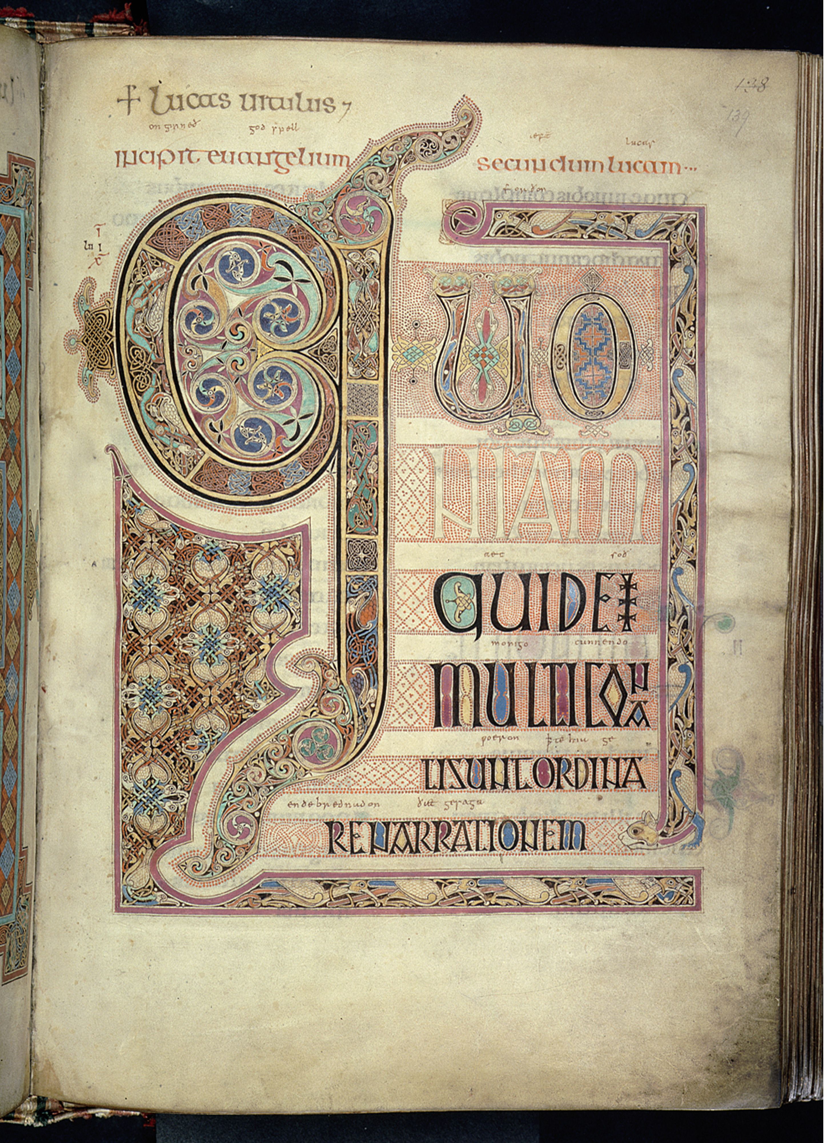
[Lindisfarne Gospels produced in Northumbria c. 680 -720]
However, there is one strand of this tale to which I can’t resist giving a wee twist: One should not overlook that fact Agricola’s great victory at Mons Graupius in 83/4 was entirely won by his auxiliary troops, mostly his native allies, or that the Highlanders defeated at Culloden in 1746 were, in part, making a last stand for the political and religious interests of Rome, against a distinctly British army.
Sources & further reading
[1] http://en.wikipedia.org/wiki/File:Agricola.Campaigns.78.84.jpg [Accessed 25/03/2011];
after Frere, S. 1974. Britania. Cardinal Books
[2] http://en.wikipedia.org/wiki/File:Georgewade.jpg [Accessed 25/03/2011]
[3] Hill, P. R. 2006. The construction of Hadrian's Wall. Tempus.
[4] see: "Excavations at the Hadrian’s Wall fort of Birdoswald (Banna), Cumbria: 1996–2000," by Tony Wilmott, Hilary Cool and Jerry Evans, in Wilmott, T. [ed]. 2009. Hadrian's Wall: Archaeological Research by English Heritage 1976-2000
http://www.english-heritageshop.org.uk/mall/productpage.cfm/EnglishHeritage/_51324/288647/Hadrian's%20Wall [Accessed 29/11/10]
[5] Breeze, D.J. 2003. "Warfare in Britain and the Building of Hadrian's Wall." Archaeologia Aeliana 32, 13 –16.
[6]http://penelope.uchicago.edu/Thayer/E/Roman/Texts/Polybius/18*.html#18 [Accessed 25/03/2011]
[7] Bidwell, P T. 2005. 'The system of obstacles on Hadrian's Wall; their extent, date and purpose'. Arbeia J, 8, 53-76.
Bidwell, Paul T. & Watson, Moira. 1989. 'A Trial Excavation on Hadrian's Wall at Buddle Street, Wallsend'. Archaeologia Aeliana, 5th ser., 17 (1989), 21-28.
Bidwell, Paul T. & Watson, Moira. 1989. 'A Trial Excavation on Hadrian's Wall at Buddle Street, Wallsend'. Archaeologia Aeliana, 5th ser., 17 (1989), 21-28.
[8] see: Welfare, H. (2000). "Causeways, at Milecastles Across the Ditch of Hadrian’s Wall". Archaeologia Aeliana. 5 (28): 13–25.
And Welfare, H. 2004. ‘Variation in the form of the ditch, and of its equivalents, on Hadrian’s Wall’. Archaeologia Aeliana, ser 5, 33, 9-24
[9]http://www.dur.ac.uk/resources/archaeological.services/research_training/hadrianswall_research_framework/project_documents/TurfWall.pdf [Accessed 25/03/2011]
Wilmott, T. 2009. Hadrian's Wall: Archaeological Research by English Heritage 1976-2000. English Heritage, Swindon. after Fig. 217 p109.
[10] http://vindolanda.csad.ox.ac.uk/exhibition/army-2.shtml [Accessed 25/03/2011]
Birley, R.,2009 Vindolanda: A Roman Frontier Fort on Hadrian’s Wall. Amberley
http://www.amberleybooks.com/shop/article_9781848682108/Vindolanda%3A-A-Roman-Frontier-Fort-on-Hadrian’s-Wall
Robin-Birley.html?shop_param= [Accessed 25/03/2011]
Robin-Birley.html?shop_param= [Accessed 25/03/2011]
This article uses illustrations based on images from Google Earth: http://www.google.com/earth/index.html [Accessed 25/03/2011]
Lindisfare Gospel from http://upload.wikimedia.org/wikipedia/commons/d/da/Lindisfarne_Gospels_folio_139r.jpg [Accessed 25/03/2011]


7 comments:
Thank you for another interesting article. I wonder if there is any sign of the naval forces which presumably would have been required to prevent or respond to attempts to outflank the wall by sea.
Hi Odin's Raven,
Thanks for you comment.
We have a great account of combined operations from Tacitus who wrote an account of Agricola's campaign;it includes a circumnavigation of Scotland, and attacks on places like the Orkney.
The main supply base in the East for the Wall was Arbeia, South Shields, [& by coincidence the HQ of my former employers]. I am less sure how this worked on the West coast, but the Romans controlled both coasts, and could always move naval forces in from the Europe if required.
Hi,
I have a question about the vallum, have you taken a closer look at where the vallum crosses the smaller streams, is there any evidence of bridge abutments ?.
Also regarding the three lane Roman roads, one currently being investigated in yorkshire by twithr.com / Roman Roads Research Organisation (RRRA), where did the Romans put the spoil from the excavated middle lane prior to backfilling with the graded material?.
No work was done on the Road other than the digging of the construction trench. The material being predominantly boulder clay was of no value in road building so the spoil was placed neatly in banks. What happens elsewhere I have no idea. Unlike other roads we can be sure this was an original construction and not utilising an existing route.
IMO. It was the digging construction trench by forced native labour that led to the rebellion that burnt London and set the project back several years.
At Chester the initial phase of the bridge was only wide enough to carry the wall, and a separate, but adjacent road bridge would be needed. [There is a lot of stone in the water down stream of the bridge abutments, but above the diversion channel].
The second phase of bridge is wide enough to carry wheeled traffic.
I expect the edge of the road to be formed by a hedge bank, which can be formed by surplus material and road cleaning - but which both controls access to the road & defines its boundary for users.
Hi, thanks for reply, is it possiblr the feature called the King's Sike is part of the timber wall?
UH, King's wicket i meant to say, my bad.
Hi Lurcio,
I never regarded it as such, I date the timber phase to 122; where there is a ditch there was a timber rampart behind it.
However, when a stone structure was built in a War Zone, it is clear to me that a temporary timber rampart was built to protect the works, which were to be protracted and take several years.
I suspect that the central sector was low priority for Nepos, and imo the subsequent construction of extra forts related to an attack on this area precisely because the Roman thought the topography was its own defence, and the existing fort at Vindolanda would be sufficient.
NB. Any structure described as "Turf" was of timber construction, the use of "Turf" being a historical tradition dating as far back as Bede, but which is disproved by the archaeology.
Sadly, there are no books on soil science written in Latin - so most academics & classicists can't understand even basic archaeological data - so defer to opinions of medieval monks and Victorian antiquarians.
Thus, Science Denial is alive and well, - living happily in your local Archaeology Dept, and is completely at home at with Institutions like Historic England, further complicating interpretation.
Post a Comment